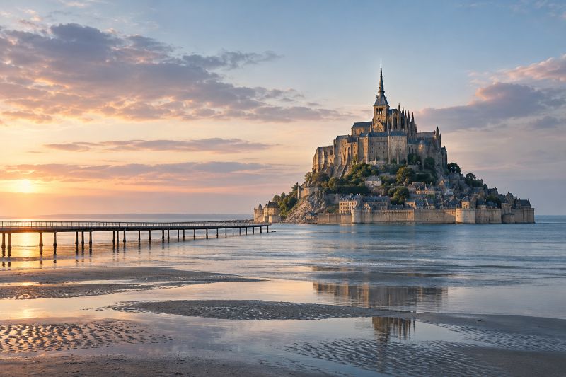
The causeway built to make Mont-Saint-Michel easier to reach nearly ended its life as an island. Built in 1878, it let silt carried in by the tides pile up in the bay. Some studies warned that without action the rock would be joined to the mainland for good by 2040.
So France knocked the causeway down.
A tide that moves faster than a walker
The bay holds some of Europe’s strongest currents and most powerful tides. National Geographic calls them the strongest in continental Europe. High tide can rise as much as 45 feet and sweep in at about 200 feet a minute, Smithsonian reported.
That made the medieval crossing deadly. Pilgrims waited for low tide, then walked across grey mud that could give way to quicksand. In the single year of 1318, 18 pilgrims drowned, and 12 more were lost to quicksand.
The abbey they walked to was built between the 11th and 16th centuries, and UNESCO lists the bay along with it.
How the bay filled in
The tides bring fertile silt with them. The people of Normandy used dikes to reclaim the land it built, and by the 19th century the shore had crept to within two kilometres of the Mont. Centuries earlier it had lain seven kilometres away.
The causeway added to the problem, as silt gathered in the bay after it opened. The area that flooded at high tide kept shrinking.
Undoing the causeway
In 2005 the French government, which owns the abbey, began a project to restore the Mont’s maritime character. The national government, the regions of Normandy and Brittany, and the European Union budgeted nearly $300 million for it.
The work took ten years and finished in 2015. Crews destroyed the causeway and built a dam on the Couesnon River, which releases water to flush silt out to sea. The car park moved inland, and shuttles now carry visitors across.
The payoff comes on the biggest tides, about 10 times a year. On those days the sea again surrounds the Mont completely, which had not happened since 1879.