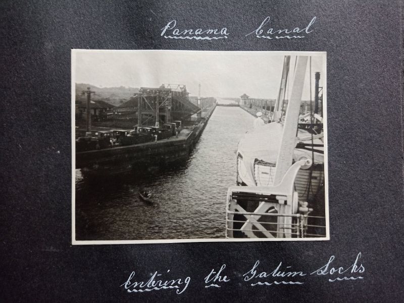
A ship crossing the Isthmus of Panama does not sail through a slot cut at sea level. It climbs a series of locks, crosses the man-made Gatún Lake, and descends again on the far side. Water alone lifts it 85 feet above the ocean, not any engine of its own. The route runs about 50 miles from Colón, on the Caribbean side, to Panama City on the Pacific.
more
How the locks lift a ship over a mountain
Panama’s own account of the waterway describes the system as a pair of water elevators. Gravity draws fresh water down from Gatún Lake through culverts beneath each set of locks, filling the chambers to float a ship upward, then draining them to lower it again on the other side. Seen from the deck, it feels less like a river than a staircase. A ship climbs three steps up to the level of the lake, crosses it, then descends three steps back to sea level. A single transit draws roughly 200 million litres of fresh water, all of it from the lake rather than the sea.
Why a staircase, not a straight cut
France tried the direct approach first, beginning excavation in 1881. Engineering problems and a worker mortality rate that investors would no longer tolerate ended the French effort by 1889. Panama’s embassy sums up that failure in one line: “financial troubles and diseases made the initiative fail.” Wait But Why put the whole project’s cost at $921 million at the time, close to $10 billion in today’s money.
Who finished it, and who runs it now
The United States completed the canal in 1914, ten years after taking over the abandoned French works. Washington kept control of the surrounding Canal Zone until 1999, when it handed the waterway to Panama under the Torrijos-Carter Treaties, signed in 1977. The Panama Canal Authority, a Panamanian government body, has run the crossing ever since.
The expansion, and the risk that keeps growing
A third, wider lane of locks, built between 2007 and 2016, lets larger Neopanamax ships transit alongside the original Panamax-sized chambers. The canal depends on the region’s heavy rainfall for its water, and it is threatened by low water levels during droughts. To secure that supply for the long term, Panama is developing the Río Indio Reservoir, meant to serve both the canal’s locks and more than half the country’s population.
Why the rainforest matters as much as the concrete
NASA’s satellite images show the protected Canal Zone as a dark green band of rainforest against the lighter green of the farmland pressing in around it. That forest keeps the water balance the locks depend on, and keeps soil from washing into the channel. Scientists watch its edges for signs that development is wearing it down. An astronaut aboard the International Space Station photographed that same boundary in January 2003: forest on one side, cleared land on the other.
The questions the canal still raises
When the BBC’s The Forum put the canal’s history to a panel in 2021, it opened by challenging the “triumph of American ingenuity” framing that has usually surrounded the project. The panel included Marixa Lasso, a Panamanian historian and author of Erased: The Untold Story of the Panama Canal. Julie Greene, who has written on the canal’s builders, and Paul Sutter, an environmental historian, joined her. Who built the canal, how it changed Panama, and what it cost the land around it are questions the programme raised rather than settled, more than a century after the last lock gate closed.