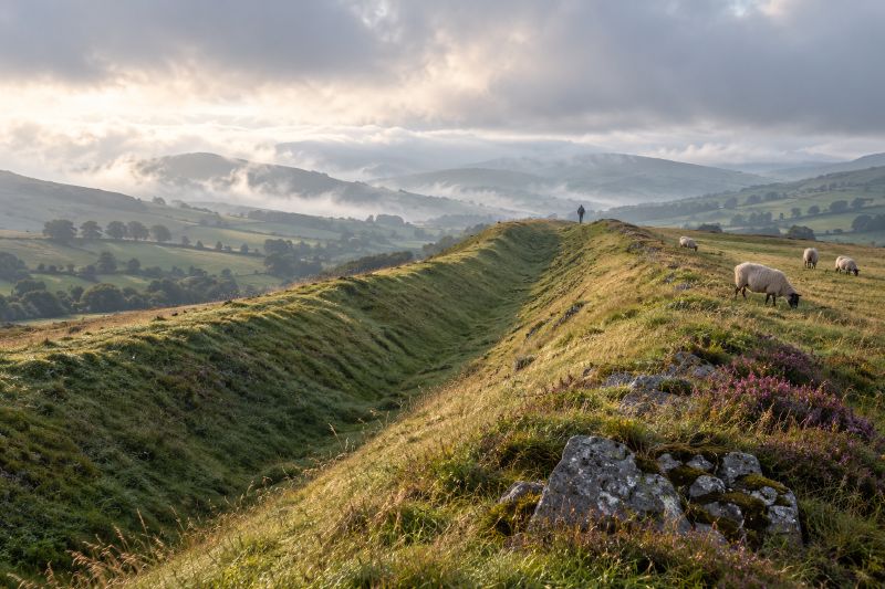
Offa’s Dyke marked the edge of an Anglo-Saxon kingdom, not a modern country. King Offa of Mercia most likely had it built once he held his throne securely, as a lasting line between his lands and the Welsh, according to Herefordshire Council’s archaeology service. The England and Wales border still runs close to it, though walkers on the dyke keep changing countries as the line weaves back and forth across the bank.
Shropshire Council dates the work to around 785 CE and calls it Britain’s longest archaeological monument, at 82 miles.
What pushed Offa to build it
Decades of raiding went both ways. The Anglo-Saxon Chronicle records Æthelbald of Mercia and Cuthred of Wessex fighting the Welsh in 743, and the Welsh Annals record Welsh raiders devastating Hereford in 760. Offa struck back at the Welsh in 777 and again in 783.
His own path to power had cost Mercia ground. Æthelbald was murdered by his bodyguard, and Offa won the civil war that followed against Beornred. During that fighting, Powys under Eliseg pushed the Mercian border back east. The Pillar of Eliseg near Llangollen is thought to record those events, and Edward Llhuyd copied its fading inscription in 1696.
The earliest written mention of the dyke comes from Asser’s life of King Alfred, written in 893. Asser wrote that Offa, a vigorous Mercian king, ordered a great dyke raised from sea to sea between Mercia and Wales.
How big it was
A bank with a ditch on its western side. Herefordshire Council says the bank once rose nearly 8m above the bottom of the ditch in places, and that the whole work reached 20m wide. The BBC gives a wider original figure of around 27 metres. The builders piled the soil from the ditch into the bank, and a V-shaped ditch at a steady 45 degree slope would have made the dyke very hard to climb.
The BBC dates Offa’s reign from 757 to 796, while Herefordshire Council ends it in 795.
Defence or display
Nobody knows how long the dyke took to build or how many people built it, and its purpose is still argued over, the BBC reported. Professor Keith Ray of Cardiff University told the Guardian that a defensive work without forts or towers looks more like a show of power. He called it a monument to a king who wanted to impress.
Where it ended has been argued over for a century. A 1925 review in Nature noted that its end point in Flintshire remained a problem, and that the author it reviewed, Mr Hewlett, thought Wat’s Dyke rather than Offa’s ended at Basingwerk. Ray’s team has since used lidar and drones to find about 12 miles of dyke nobody had recorded, the Guardian reported. Those finds are replacing the old belief that it never ran from sea to sea.
Why it needs protecting now
A recent survey found only 8.7% of the monument in favourable condition, Shropshire Council said in 2022. Tree roots break into buried archaeology, and storms that topple trees tear chunks out of the earthwork. The council said Cadw and Historic England were jointly funding a conservation project with around £500,000 over three years.
In 2021 the 177-mile Offa’s Dyke Path National Trail turned 50, and as many as 3,000 walkers completed it each year, the Guardian reported. It follows the dyke itself for around 40 of the monument’s 82 miles.