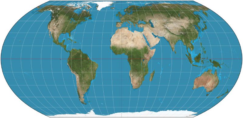
The United Nations general assembly has voted to phase out the Mercator world map in favour of a projection based on the 2018 Equal Earth design. The resolution passed with 164 votes. The United States cast the only vote against, calling it “superfluous”, and six countries abstained.
more
On a Mercator map, Africa looks about the size of Greenland. The continent is in fact 14 times larger than the Danish territory. Togo led the campaign for the resolution on behalf of the African Union, which endorsed the Correct the Map campaign in August 2025.
Why Mercator shrinks Africa
The Flemish cartographer Gerardus Mercator drew his projection in 1569 to help sailors find their way at sea. It keeps angles and directions true over short distances, but it badly distorts area towards the poles. Places near the equator come out much smaller than they are, and high-latitude regions look much larger.
Critics have called the effect “cartographic colonialism”. Robert Dussey, Togo’s foreign affairs minister, said before the vote that the question was scientific rather than political.
What Equal Earth does differently
Bojan Šavrič, Bernhard Jenny and Tom Patterson invented Equal Earth in 2018. It keeps the relative size of every area, which Mercator does not. They built it after Boston Public Schools adopted the Gall-Peters projection in March 2017. Gall-Peters also keeps area, but cartographers objected to its extreme stretching near the poles. The three designers wanted an equal-area map that looked better.
The International Cartographic Association welcomed the attention the vote brought to map projections. It also warned that every projection distorts something, and that no single projection is correct for every purpose. Equal Earth’s own creators said it should be used only where an equal-area map is required, because continental shapes suffer.
What actually changes
A UN resolution cannot be enforced. No country or institution has to drop Mercator or adopt the new projection. The Guardian expects the vote to feed into school curriculums and everyday technology, where Mercator is widely used.
France has already committed to change. Its foreign minister, Jean-Noël Barrot, said France would abandon Mercator for maps more faithful to real surface areas. France will use the Eckert IV projection, which is close to Equal Earth.
Togo plans a meeting in its capital, Lomé, in the first quarter of next year to work out how to put the resolution into practice. Unesco, the African Union and Google Maps are among those invited. “To those who say why now, I say: why not?” Dussey said before the vote.